
Terms : Hide Images
| 1592930956 | geography | The study of the earth and the physical and human features. |  | 0 |
| 1592930957 | equator | The imaginary line of latitude that encircles the middle of earth, dividing it into northern and southern halves. | 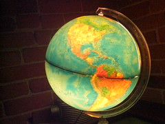 | 1 |
| 1592930958 | globe | A three-dimensional representation of earth. |  | 2 |
| 1592930959 | topographic map | A reference map that shows natural features (mountains, rivers, oceans...) in different shades of brown, green, and blue; and man-made features (cities, borders). |  | 3 |
| 1592930960 | absolute location | The exact place on earth, described using latitude and longitude. |  | 4 |
| 1592930961 | prime meridian | The imaginary line of longitude that divided the earth into eastern and western hemispheres. |  | 5 |
| 1592930962 | map | A two-dimensional representation of the earth's surface. |  | 6 |
| 1592930963 | thematic map | A map that shows a pattern or some other information OTHER THAN what is shown on a topographical or reference map. It all depends on the theme. For example, it may show what religions are most common is certain places, or where Irish people migrated to over the last two hundred years, or could show where bananas are grown in the world, or locations where Star Wars Episode V was shot. There is literally an infinite number of things thematic maps can show. It just depends on the theme. |  | 7 |
| 1592930964 | relative location | A way to describe where something is in relation to other places around it. There is an infinite number of ways to describe this for any one location. For example, the United States is above Mexico. The United States is west of Europe. I could go on forever. The United States is a six-hour flight from Europe. |  | 8 |
| 1592930965 | latitude | A set of imaginary lines that run east-west, parallel to the equator, and help find how far north and south places are from the equator. |  | 9 |
| 1592930966 | cartographer | A mapmaker. |  | 10 |
| 1592930967 | GIS | A type of computer program that allows cartographers to solve problems by using maps. They layer data for areas on top of each other. |  | 11 |
| 1592930968 | hemisphere | Each half of the earth (there are four - north, south, east, and west). |  | 12 |
| 1592930969 | longitude | A set of curving imaginary lines that run north-south, curving away from the prime meridian and coming together at the north and south poles. They help find how far east and west things are from the prime meridian. |  | 13 |
| 1592930970 | map projection | A way of taking the round surface of the earth and showing/projecting it on a flat surface. It is always going to be distorted, so it will never be totally accurate. For example, this map makes places at the top and bottom of the map look way bigger than they really are. Things in the middle are pretty accurate. |  | 14 |
| 1592930971 | GPS | A system that uses at least three satellites at one time to find out where you are located. |  | 15 |
| 1592930972 | scale | How much land a map shows, but it's backwards from what you would think. A small scale map shows a TON of land. A large scale map shows much less land. For example, the map shown here is the smallest scale you can get - it shows the whole world. |  | 16 |
| 1592930973 | compass rose | A symbol on a map that shows you which way north is. |  | 17 |
| 1592930974 | location | One of the five themes of geography, used to describe where things are. It includes absolute location and relative location. |  | 18 |
| 1592930975 | place | One of the five themes of geography, used to describe what a place is like. For example, Chicago is a city in the Midwest United States. It is next to a Lake. It has hot summers and cold winters. It has about three million people, of which about a third are white, a third are black, and a third are Hispanic. |  | 19 |
| 1592930976 | human-environment interaction | One of the five themes of geography, used to describe how the environment affects humans and how humans affect the environment. |  | 20 |
| 1592930977 | movement | One of the five themes of geography, used to describe things that move from one location to another. |  | 21 |
| 1592930978 | region | One of the five themes of geography, used to describe areas where there is something in common. It includes functional, formal, and perceptual versions. |  | 22 |
| 1592930979 | reference map | A map that has the basics any map should have: boundaries, roads, cities, and sometimes major landforms. For example, when you look up a map on Google, the standard map you see is a reference map. |  | 23 |
| 1592956442 | formal region | An area that has a measurable boundary. Ex: The area where >50% of people speak French, the "Corn Belt" - where corn is the most common crop, the area where >10% of the population is unemployed... | | 24 |
| 1592956443 | functional region | An area that has something in common related to the movement of something. Examples: Chicago's reach could be mapped by who subscribes to the Chicago Tribune newspaper, or where people live that work in Chicago, or people that use Chicago's airports as their main airport. |  | 25 |
| 1592956444 | perceptual region | An area that doesn't have official boundaries because no one can agree on what is the real boundary (it is up to everyone to PERCEIVE it on their own) Example: what states make up the "Midwest" United States? Not everyone agrees on the same states, but we can at least name many of the same states. |  | 26 |