| 14805131517 | Peters Projection |  | 0 | |
| 14805138984 | Mercator Projection |  | 1 | |
| 14805146372 | conic projection |  | 2 | |
| 14805154773 | thematic map |  | 3 | |
| 14805161570 | reference map |  | 4 | |
| 14805165119 | Dot Map |  | 5 | |
| 14805169740 | Robinson Projection |  | 6 | |
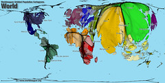
| 14805174511 | cartogram |  | 7 | |
| 14805179068 | Chloropleth Map |  | 8 | |
| 14810073966 | vgi | volunteered geographic information | 9 | |
| 14810073967 | Mashup | a map that overlays data from one source on top of a map provided by a mapping service | 10 | |
| 14810082970 | ratio, graphic, and written | what three ways are map scales presented | 11 | |
| 14810087641 | ratio | the numerical ratio between distances on the map and and earth's surface | 12 | |
| 14810096688 | Written map scale | describes the relationship between map and Earth distances in words | 13 | |
| 14810098961 | graphic map scale | consists of a bar line marked to show the distance on earths surface |  | 14 |
| 14810122908 | shape, distance, relative size, direction | Four types of distortion | 15 | |
| 14810126614 | Satellites, Tracking stations, a receiver | What three elements does the GPS in the US include? | 16 | |
| 14810126615 | Geotagging | identification and storage of a piece of information by its precise latitude and longitude coordinates | 17 | |
| 14810130402 | GIScience | The development and analysis of data about Earth acquired through satellite and other electronic information technologies | 18 | |
| 14810138978 | geographic grid | a system of imaginary arcs drawn in a grid pattern on Earth's surface |  | 19 |
| 14810153133 | Isoline Map |  | 20 | |
| 14810157876 | graduated symbol map |  | 21 | |
| 14810165128 | location, region, place, movement, and human-environment interaction | five themes of geography | 22 | |
| 14810170525 | uniform region | formal region | 23 | |
| 14810183615 | vernacular region | perceptual region | 24 | |
| 14810186807 | functional region | nodal region | 25 | |
| 14810193207 | Human Environment Interaction | the study of the interrelationship between people and their physical environment | 26 | |
| 14810280348 | tracking station | monitors satellites | 27 | |
| 14810283124 | receiver | locates up to four satellites, figures distance to each, and pinpoints its own location | 28 | |
| 14810726015 | Cartographic Scale | refers to the way the map communicates the ratio of its size to the size of what it represents | 29 | |
| 14810726016 | Geographic Scale | scale of analysis | 30 | |
| 14810802589 | Geography | study of the earth's surface | 31 | |
| 14810802590 | Human Geography | The study of where and why human activities are located where they are | 32 |
ap human Flashcards
Primary tabs
Need Help?
We hope your visit has been a productive one. If you're having any problems, or would like to give some feedback, we'd love to hear from you.
For general help, questions, and suggestions, try our dedicated support forums.
If you need to contact the Course-Notes.Org web experience team, please use our contact form.
Need Notes?
While we strive to provide the most comprehensive notes for as many high school textbooks as possible, there are certainly going to be some that we miss. Drop us a note and let us know which textbooks you need. Be sure to include which edition of the textbook you are using! If we see enough demand, we'll do whatever we can to get those notes up on the site for you!

